Maryland Diatomite Locations
I am finally documenting the various locations where I've collected diatomite in Maryland. Maryland has a lot of fossils and a lot of shoreline. Readers should be aware that most of my diatomite hunting in Maryland was done between 2002 and 2008 so I am not sure how many of these locations will still allow access. I will try to organize the presentation according to the age of the diatomite.
Dunkirk, Maryland
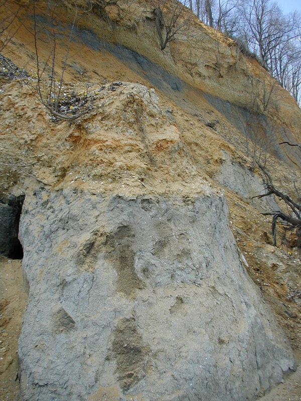
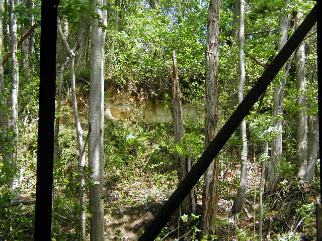
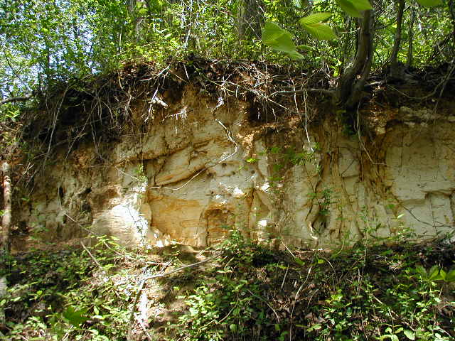
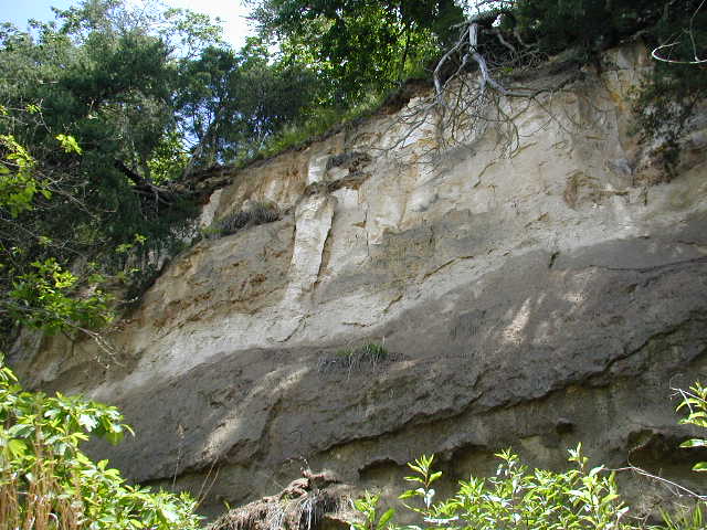
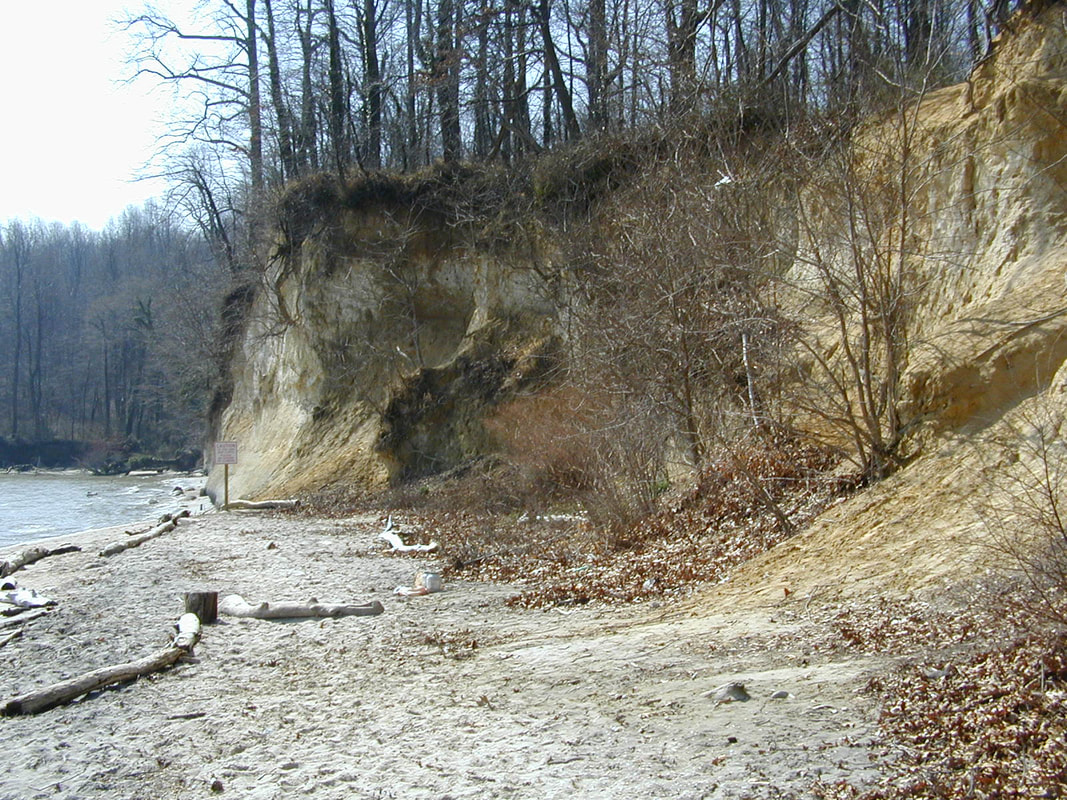
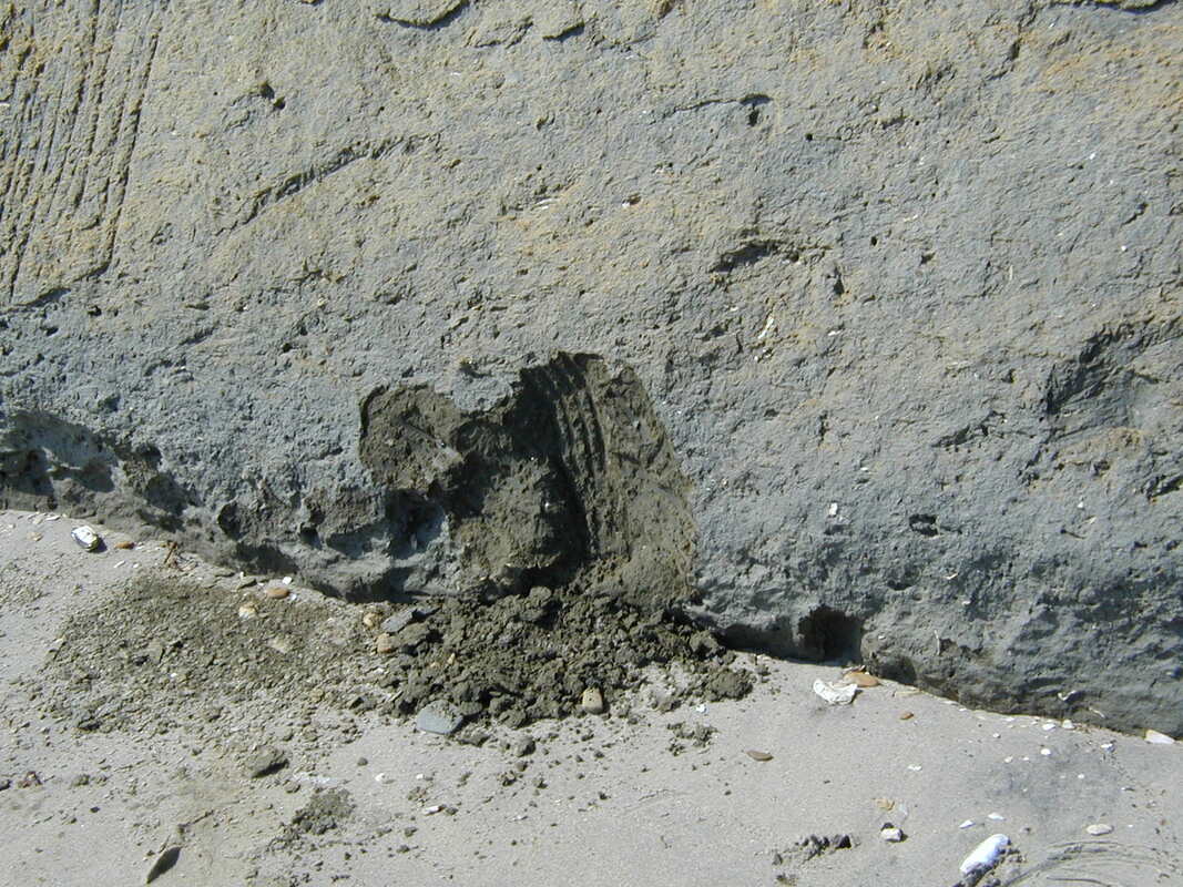
On the east bank of the Patuxent river due west of the Dunkirk, Maryland town center is some of the oldest and best quality diatomite I have ever found. If you notice any diatom samples labeled "Dunkirk" they likely were obtained here during my visit in 2002. During part of the last century this diatomite was commercially mined and processed along the river, so there are only a very few outcrops still visible. But a walk along the banks of the Patuxent may yield some marvelous finds such as this. I believe that the "Nottingham" material of the old diatomists was actually collected right across the Patuxent river (the west bank) from Dunkirk. If you look on Google Earth or Mapquest, you will see that there is a road called Nottingham which runs to the river and then runs parallel for a short distance. This area would be very similar to where I found this Dunkirk material on the East side of the river. Further research has validated this suggestion that the old "Nottingham" diatomite is the same as that found at Dunkirk. A town called Nottingham was present on the west bank of the Patuxent right across from my collection site but it burned down in 1901. See http://wikimapia.org/1780502/Nottingham-MD.
Further, it appears that this "Nottingham" diatomite is also the old "Bermuda Earth" of the old diatomists. So, that makes Dunkirk = Nottingham = Bermuda Earth! The diatomite found here is part of the Calvert Formation and is listed as Shattuck's zone 3A. Most notable is the occurrence of the marker diatom, Actinoptychus heliopelta.
Further, it appears that this "Nottingham" diatomite is also the old "Bermuda Earth" of the old diatomists. So, that makes Dunkirk = Nottingham = Bermuda Earth! The diatomite found here is part of the Calvert Formation and is listed as Shattuck's zone 3A. Most notable is the occurrence of the marker diatom, Actinoptychus heliopelta.
|
|
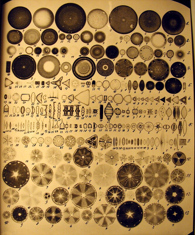
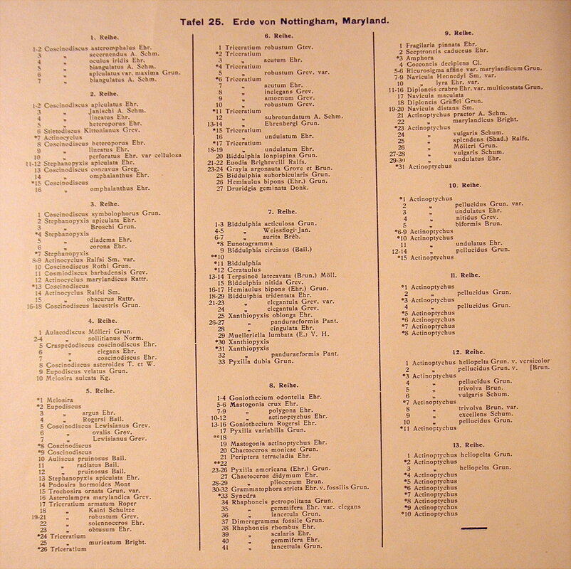
Below is an old plate and index of diatom material found in "Nottingham, Maryland" It's really close to that found in my Dunkirk sample.
|
|
Pope's Creek
At Pope's Creek, MD on the banks of the Potomac River just south of where the creek enters the river the top layer of the cliff is diatomite. This material is just slightly more recent than that at Dunkirk, MD. It contains many of the same forms as that at Dunkirk but lacks Actinoptychus heliopelta. I collected material just to the right of that big tree root on top of the cliff. This location is behind Gilligans restaurant. The diatomite is listed as Shattuck's zone 3B. The material at the base is green Eocene sand.
Brownie's Beach (Bayfront Park)
At Brownies Beach, aka Bayfront Park, there is a lot of diatomite within easy reach. This would be a good place to take the family for a day to enjoy the ocean and to collect some diatomite.
Unfortunately in the time since I visited (2002) and today, they no longer allow out-of-state residents to use this park.
Unfortunately in the time since I visited (2002) and today, they no longer allow out-of-state residents to use this park.
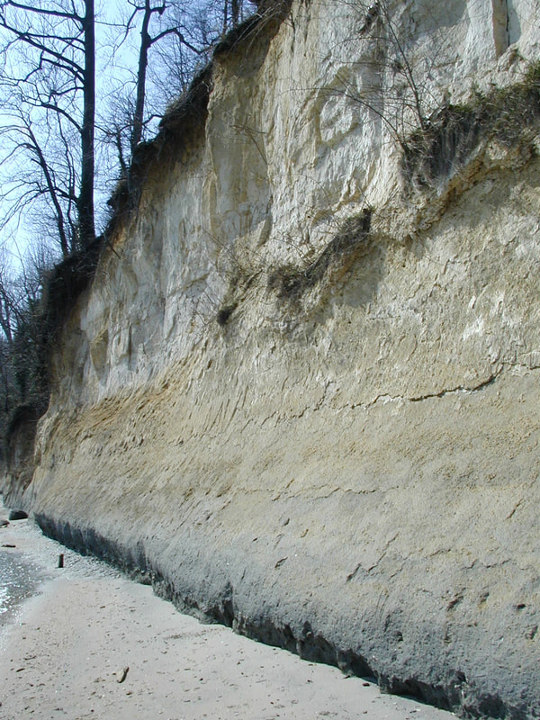
I collected one sample right at the base of the cliff at the water. This is my Brownie Beach 0' sample. This is Shattuck's zone 5 I believe, which is right above the thin zone 4 shell line marking the break between the Fairhaven member and the Plum Point Marl member of the Calvert Formation.
I collected another sample at about the 8' level, about the height I could reach easily. I sampled near the holes. This is my Brownie Beach 8' sample. I'm not really sure what Shattuck zone this is.
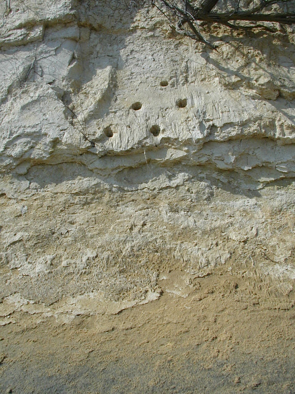
Here's a shot of the cliff with water. You can just see the thin line of shells just above the water that is Shattuck's zone 4 between the Fairhaven member and the Plum Point Marl member of the Calvert formation.
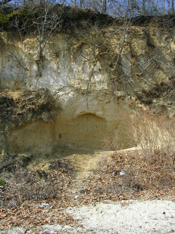
Returning back to the beach area, I collected a sample in this "cave" which I estimated was 15' above sea level. This is my Brownie Beach 15' sample. I'm not really sure of the Shattuck zone here either.
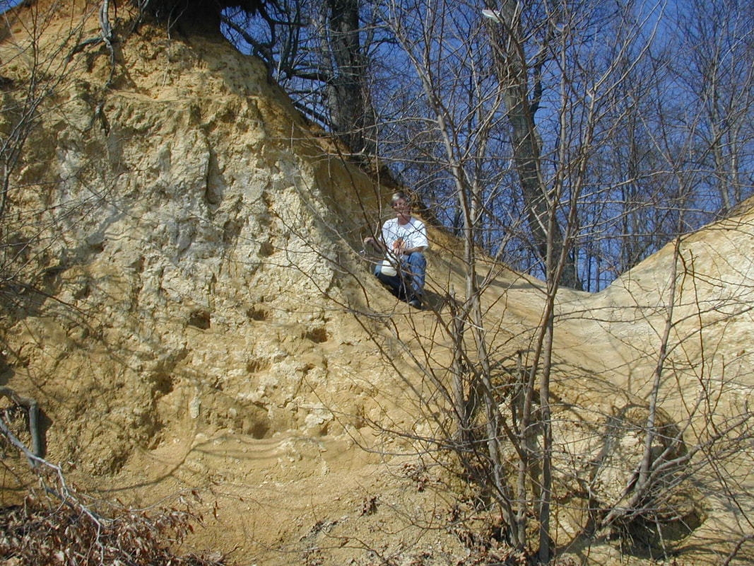
I went to the top of the cliff and carefully climbed down a little to collect a sample that I estimate was 30' above sea level. So this is my Brownie Beach 30' sample. This is probably located somewhere between Shattuck's zone 10 and 15. I think Shattuck's zone 16 is the very top but I could be wrong.
Matoaka Cottages
Matoaka Cottages is another place to collect material. You can pay a fee to park and collect for a day, or you can rent one of the cottages for a week or long weekend. The cliffs here are part of the more recent Choptank formation and are part of the Saint Leonard's member and include Shattuck's zones 15 to 21. Walk to the beach and head north along the shore. There are sites where you can collect material. Here's a picture of part of the Matoaka cliffs just north of the cabins. I sampled the low gray band (Matoaka Low), and the next band up (Matoaka medium) and I found pieces on the next higher gray band on the beach (Matoaka High). Most of the material was sand but there were some very interesting diatom forms in these, especially in the Matoaka High material.